Wood frame has a 3cm face width. Printed on 350g matt texture paper and shipped ready to hang.
Artwork size: 16”x12”.
Glass cover.
Bright white mount has a border of 5.7cm.
Overall Dimensions (W x H): 22″x18″
- Tax included.
- Refunds & Returns.
£29.00
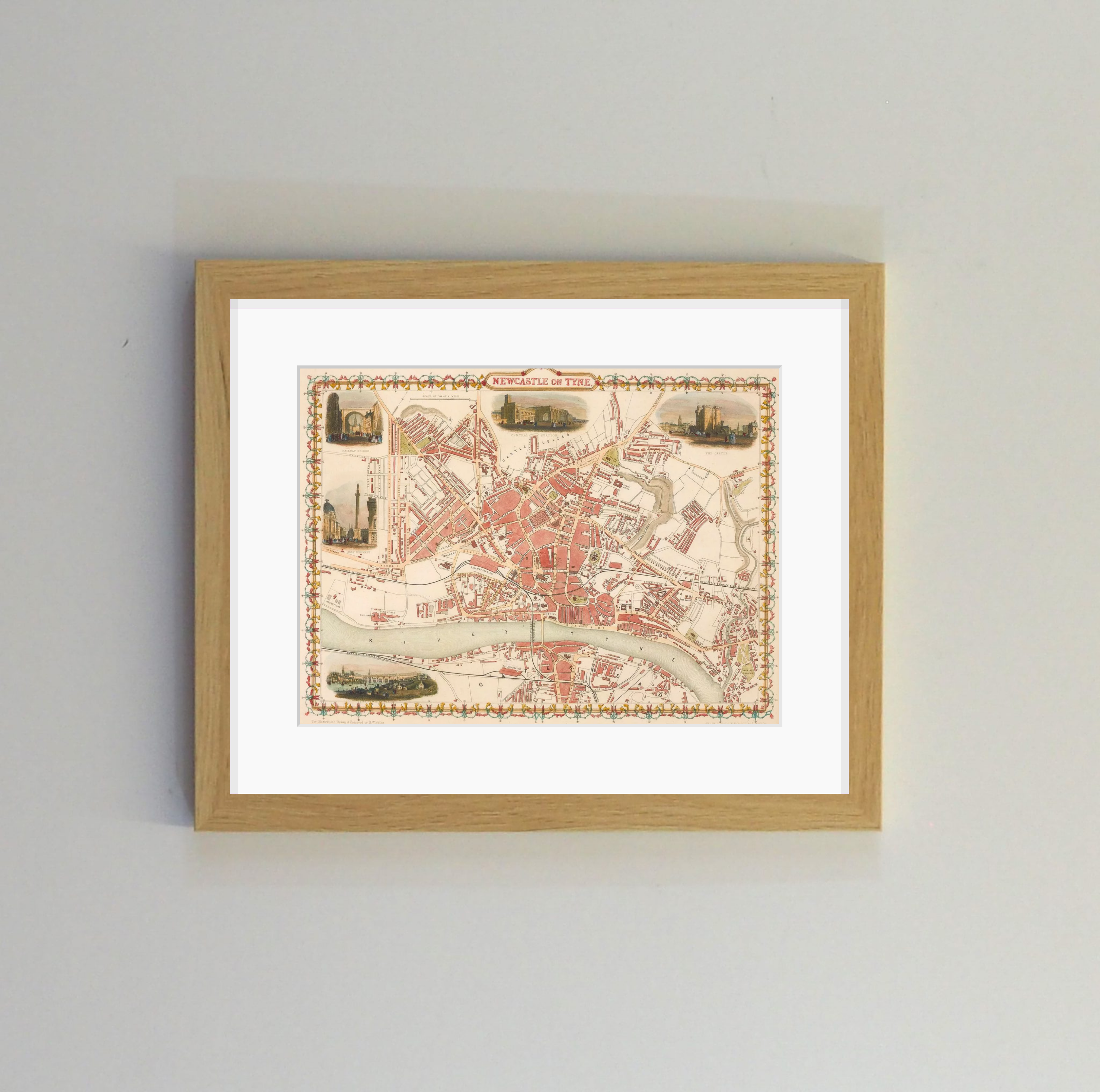
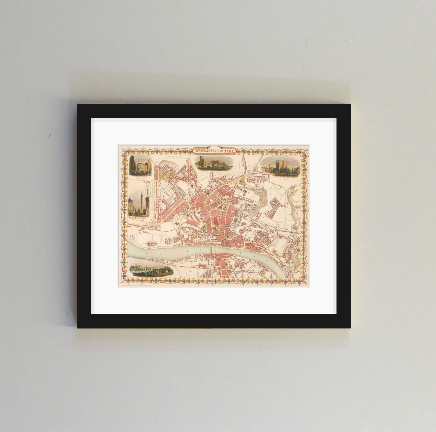
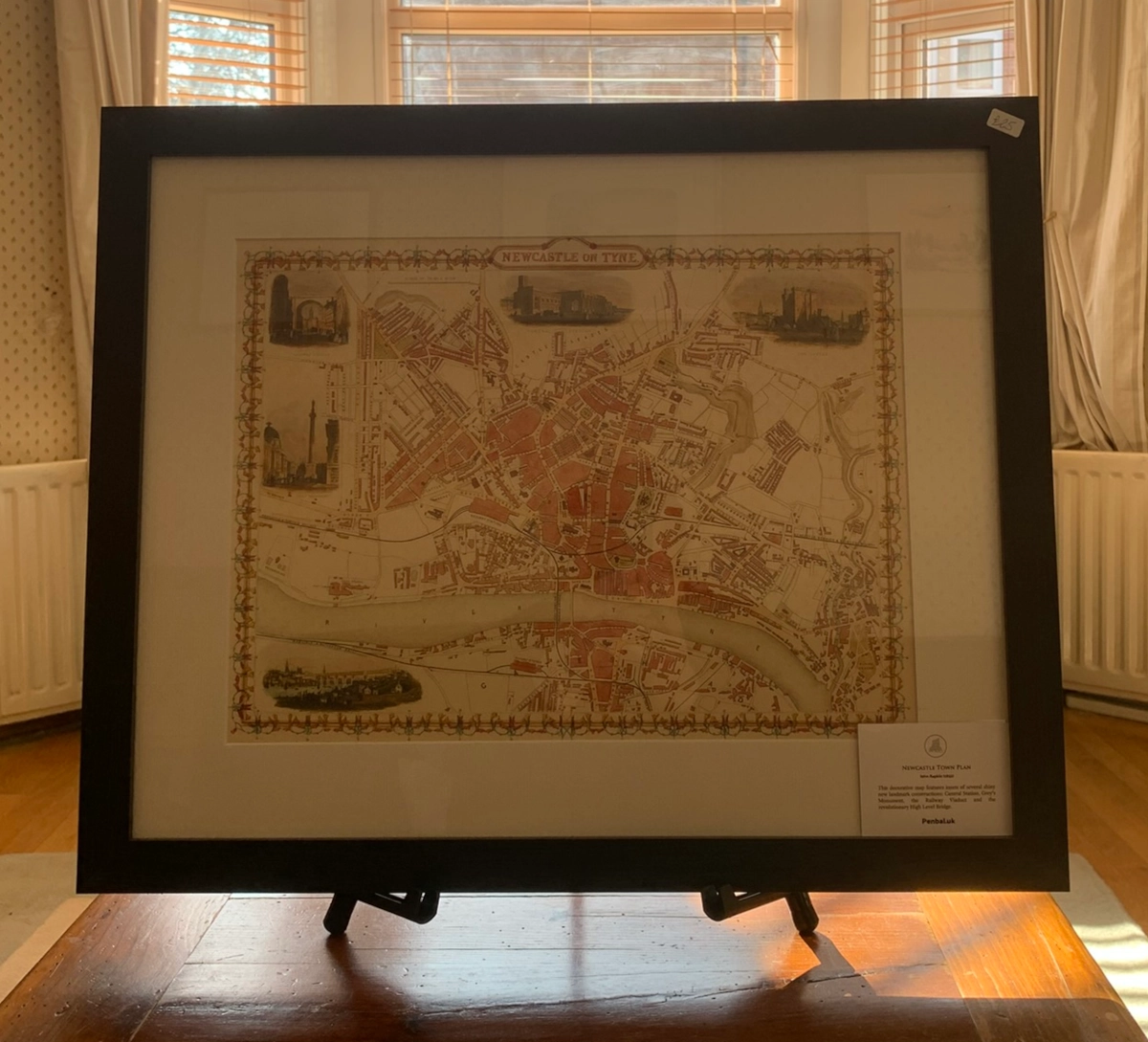
‘Newcastle Town Plan’ by John Rapkin for The Illustrated Atlas and Modern History of the World published by John Tallis for the Great Exhibition in 1851.
Engraved in steel by the masterful cartographer John Rapkin, this colourful and decorative town plan features insets of several shiny new landmark constructions: the Central Station, Grey’s Monument, the Railway Viaduct, the newly-restored Castle Keep, as well as the revolutionary High Level Bridge. The map depicts a period when Newcastle was transformed on the back of enormous wealth from the coal trade and was arguably the most technologically advanced city in the world.
Wood frame has a 3cm face width. Printed on 350g matt texture paper and shipped ready to hang.
Artwork size: 16”x12”.
Glass cover.
Bright white mount has a border of 5.7cm.
Overall Dimensions (W x H): 22″x18″
| Frame Colour | Black, Light Oak |
|---|


Reviews
There are no reviews yet.