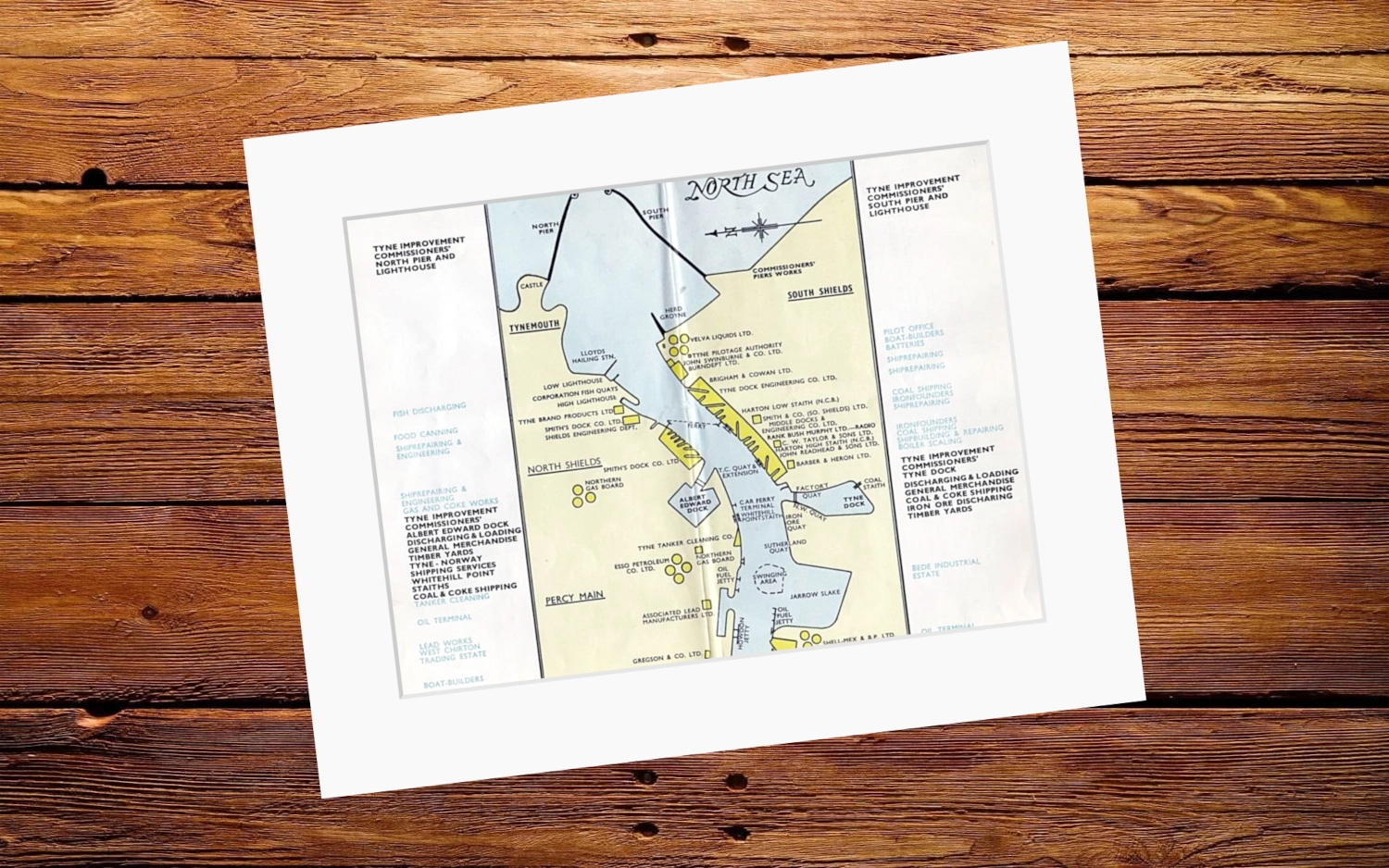
Map of the River Tyne — Tyne Improvement Commission (1950s)
Overall Size: 20″x16″
Art size: 16”x12”
Printed on 350g matt texture paper.
Bright white mount has a border of 5.7cm.
- Tax included.
- Refunds & Returns.
£15.00
1 of 5 sections of a fold-out map produced by the Tyne Improvement Commission in the post-War years. This section, from the Piers to Howdon, shows what a hive of activity the area was, at time when a quarter of the ships on the planet were either built or repaired on the Tyne.
Overall Size: 20″x16″
Art size: 16”x12”
Map of the River Tyne — Tyne Improvement Commission (1950s)
Overall Size: 20″x16″
Art size: 16”x12”
Printed on 350g matt texture paper.
Bright white mount has a border of 5.7cm.
Reviews
There are no reviews yet.