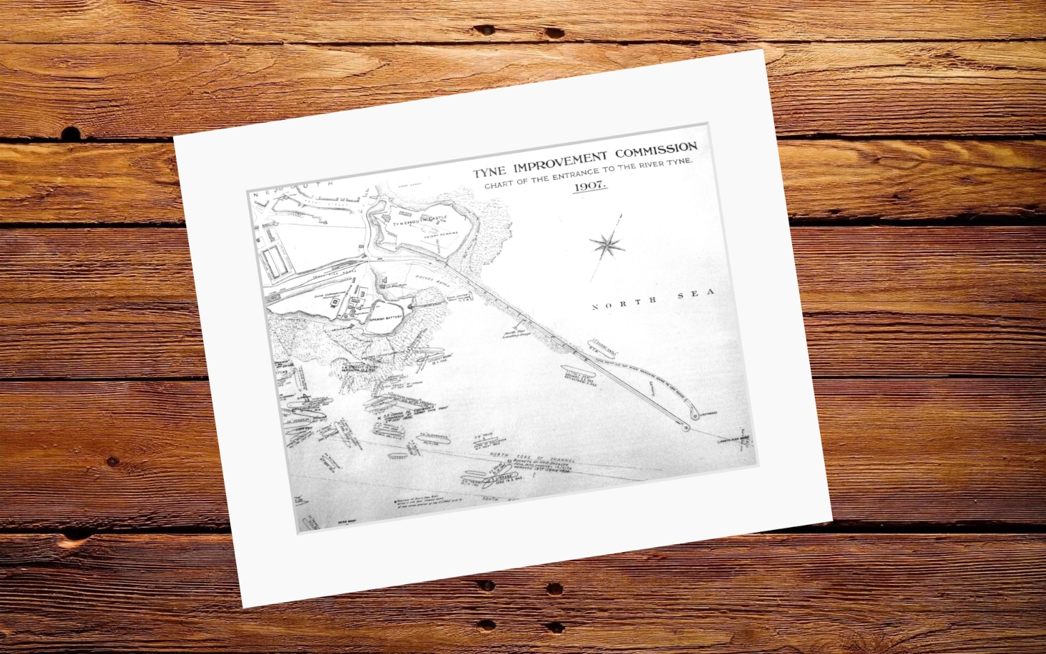
Chart of the Entrance to the River Tyne — Tyne Improvement Commission (1907)
Overall Size: 20″x16″
Art size: 16”x12”
Printed on 350g matt texture paper.
Bright white mount has a border of 5.7cm.
- Tax included.
- Refunds & Returns.
£15.00
1 of 5 Charts of the river showing the location of sunken and stricken vessels along this notoriously treacherous stretch of channel and shoreline.
Overall Size: 20″x16″
Art size: 16”x12”
Chart of the Entrance to the River Tyne — Tyne Improvement Commission (1907)
Overall Size: 20″x16″
Art size: 16”x12”
Printed on 350g matt texture paper.
Bright white mount has a border of 5.7cm.

Reviews
There are no reviews yet.