By Crasterfarian
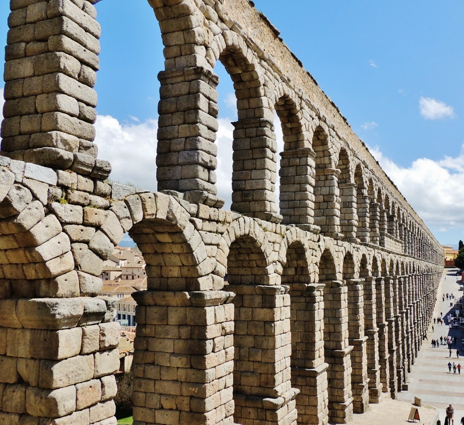
We’ve all stood in awe of the grand Roman aqueducts that still rise across the landscapes of Europe: feats of precision engineering that carried fresh water across valleys, plains and even tunnelled through mountains to the beating hearts of Roman towns. These amazing feats of construction that would be difficult to replicate today, still span some cities like Segovia in Spain.
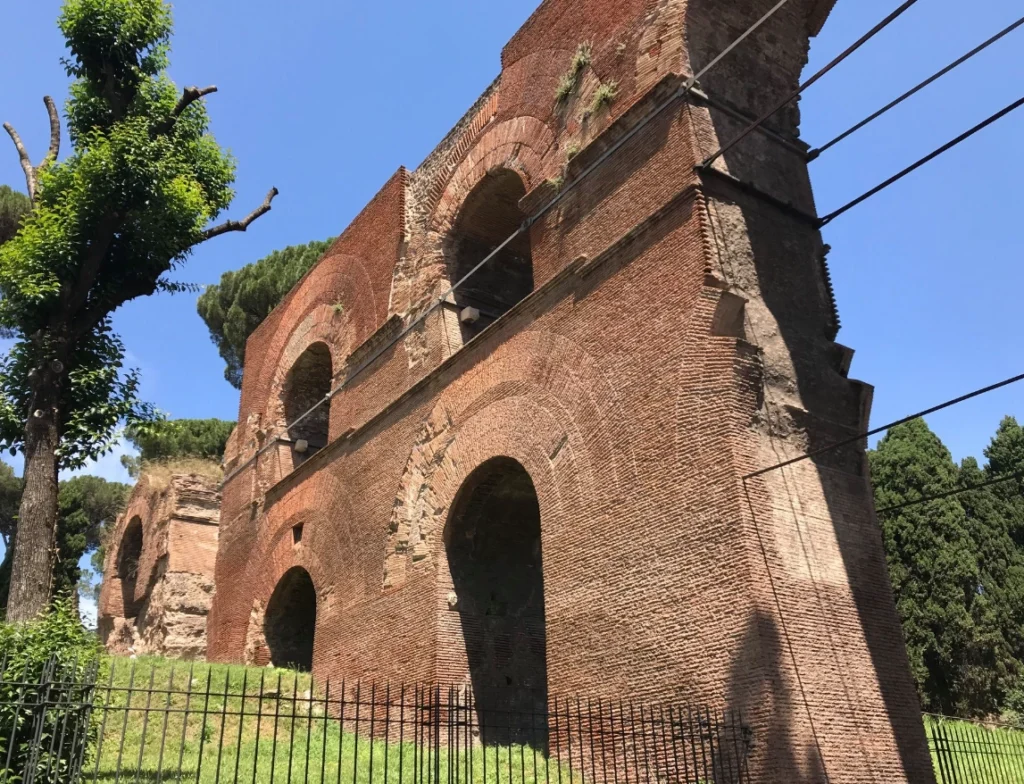
Another such wonder was completed by Emperor Claudius in AD 50 to bring water to the Palatine Hill in Rome.
But did you know that here in Northumberland, tucked away among the windswept ridges of Hadrian’s Wall, we had an aqueduct of our own?
At Great Chesters Fort, known to the Romans as Aesica, something remarkable was attempted. This spot was originally the site of Milecastle 43, but the area became strategically important enough to warrant a full Roman fort to guard the vulnerable Caw Gap, a natural weakness in the line of the Wall. So the milecastle was demolished, and the fort established around AD 128.
During the fort’s construction, or very soon after, certainly before AD 130, the Romans constructed a ten-kilometre subterranean aqueduct, an extraordinary feat by any standard.

Its path can be traced across the landscape, like here, detailed in the image above, just west of the Caw Burn.
The aqueduct drew water from a dammed pool the Romans created on the Caw Burn, just four kilometres away from the fort as the crow flies. Its route can be seen where it skirts along the side of the Caw Burn then goes around an Iron Age hillfort.
I often wonder if the locals were evicted… or massacred to move them along. I would have thought the Romans wouldn’t want anyone in the hillfort using this as a sewer to taint the their water supply.
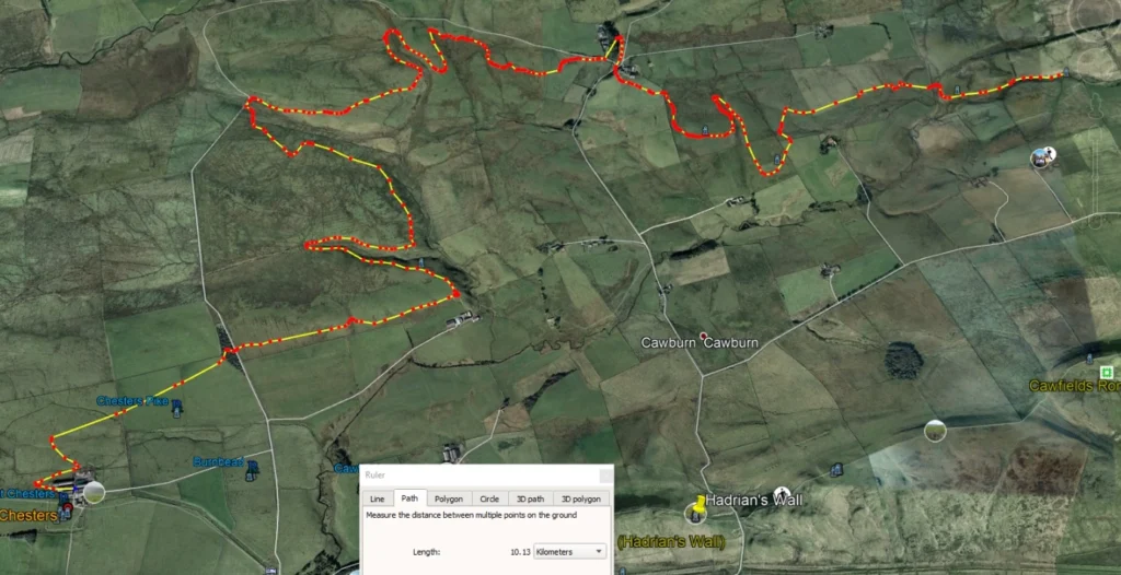
I’ve mapped the route on Google Earth, and it’s also visible on OS maps if you fancy tracing it yourself. The winding trail cuts quietly through the Northumbrian landscape, mostly hidden from view, but still there. To maintain the gentle gradient needed for water to flow, the channel had to meander across the land, stretching a full ten kilometres in length. The buried culvert was only twenty inches wide, twelve inches deep and dropped just twenty metres across that distance.
It demonstrates an utterly astonishing level of precision, especially without the aid of modern surveying tools. By today’s standards, using GPS and laser-guided levelling, this would be a precise and demanding job. For Roman engineers, using rods, plumb lines and sheer experience, it was nothing short of genius.
But here’s the twist.
According to some research, there’s a real possibility that the Aesica aqueduct was never actually used. After all the labour, planning, and effort, it may have been abandoned before it served its purpose. A white elephant of Roman engineering.
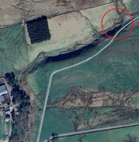
The reasons aren’t entirely clear, but it’s thought the missing link in the route is somewhere up this little valley to the north of a modern-day farm.
Unless of course, the Romans built something above the ground to bridge the gap, maybe Northumberland’s very own miniature Segovian-style aqueduct in brick and stone.
To build a ten-kilometre channel, even shallow and narrow, would have taken hundreds of labourers working for many months, maybe more. Every inch had to be dug, shaped, lined, and maintained by hand, through a landscape of wind, stone and stubborn soil, not to mention angry raiding parties of locals.
And yet, it may have been left dry.
In my opinion, and my opinion often causes heated conversations especially on Facebook, the Romans will have made this work. Lack of physical evidence doesn’t mean something didn’t happen. The bridging part may have been made of lead-lined wood and simply rotted away over many Northumbrian winters leaving no trace.
Cilurnum
Elsewhere, shown in the image below, at Chesters Fort (Cilurnum ), a smaller aqueduct brought water through the north-west facing gate, even though the River North Tyne runs along the southern and eastern edge of the fort.
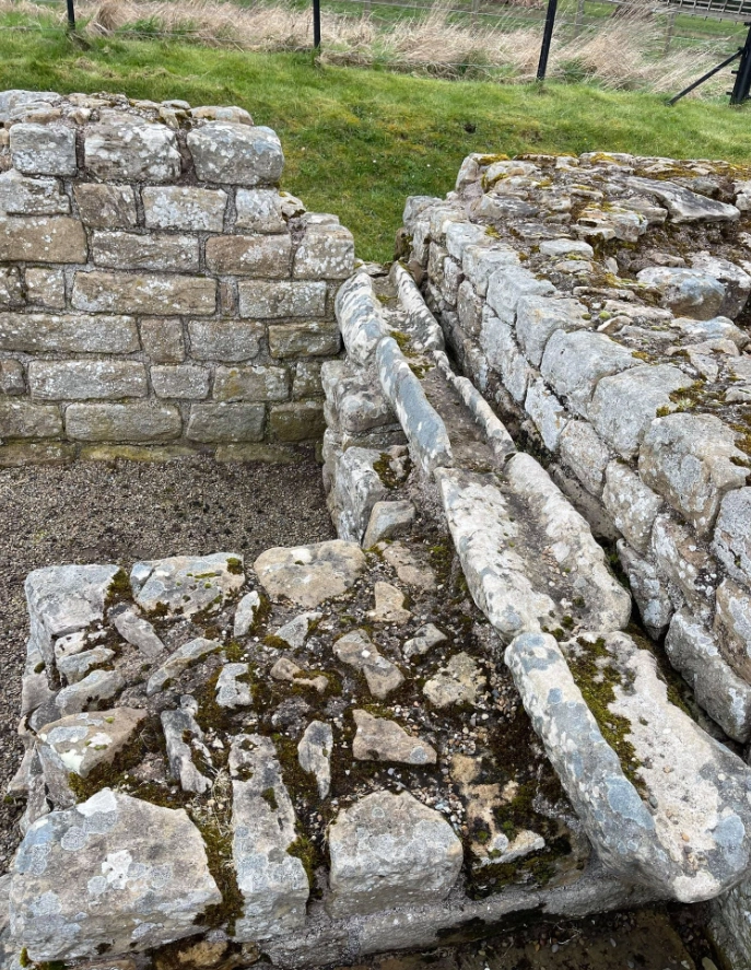
This shows how seriously the Romans took water management, always favouring gravity-fed, clean sources over unpredictable riverbanks.
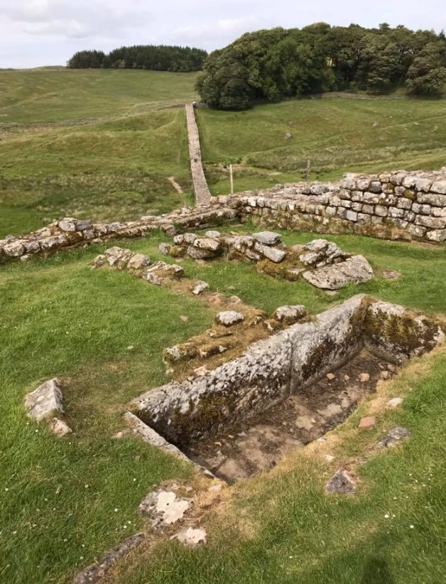
Vercovicium
At Housesteads (Vercovicium), the problem was even more difficult. There was no natural water source within the fort at all. To solve this, the Romans installed a series of cisterns throughout the site to capture and store rainwater.
The Knag Burn Gate (a later 3rd Century addition, piercing Hadrian’s Wall) and one of those cisterns can be seen in the image below.
Interestingly, also in this image can be seen a depression in the ground on the hill, on the other side of the valley just north of the Wall. This site was initially thought to be a Roman amphitheatre by the early antiquarians, and it is labelled as such on older maps.
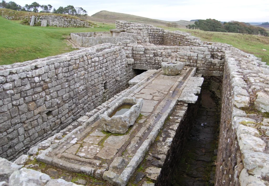
Northumberland’s first, indoor flushing netty
Still, the cistern and rainwater system weren’t enough. Additional water had to be brought up daily by cart from the Knag Burn far below the fort.
This would have been a constant, physically demanding task for the garrison, especially given the large amounts of water needed to operate Housesteads’ flushing toilets. The system there might have looked advanced, but it relied entirely on the availability of water, and that meant effort.
Water was essential not just for drinking, but for hygiene, sanitation, animals, cooking and morale. A fort without water was a fort that couldn’t last.
So, while tourists marvel at the towering aqueducts of Provence and Segovia, spare a thought for the one that lies hidden in Northumberland’s hills. Dug with vision. Abandoned with mystery. Still marking the landscape two thousand years later.
Ironically, it would be 1800 years before the inhabitants of Northumberland would be able to have indoor flushing toilets, let alone underfloor heating.
But hey… what did the Romans ever do for us?
With love from the Crasterfarian xx
Yes, this Roman viaduct, is on the OS map, and has always intrigued me. The occasions when dry weather made this necessary, are still rare!
All castles also needed internal storage to withstand any lengthy attack.
Must admit that when I first learned of the Great Chesters aqueduct a few years ago I could barely believe it. I really must go and see it sometime!