By Crasterfarian
It’s all around us. History seeps from every inch of our land. Sometimes it’s visible, other times its very subtle.
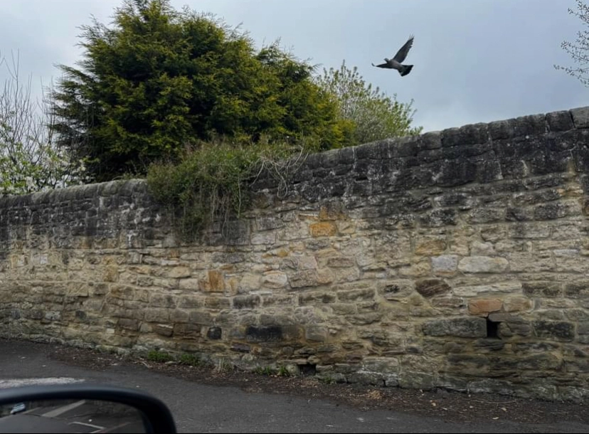
At first glance, it’s just a wall, stone on stone, rough with time, it sat innocuously in the urban landscape, scarred and stained with the soot as the nearby factories belched their guts into the air of the Industrial Revolution.
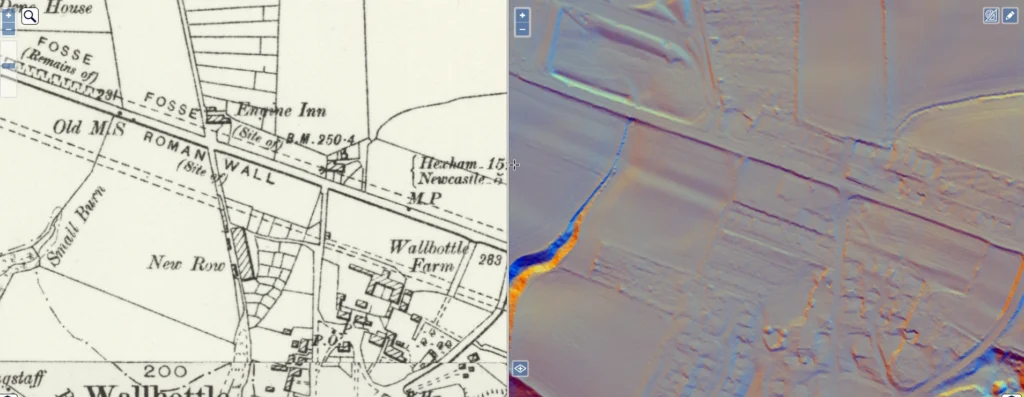
It’s in that space left by the legions, just an old wall, by a road, opposite St Cuthbert’s RC Primary School in Walbottle.
But pause a moment and the stones begin to whisper.
Here, a shallow curve in the central masonry gives the game away. The wall’s foundation has sagged gently into something far older.
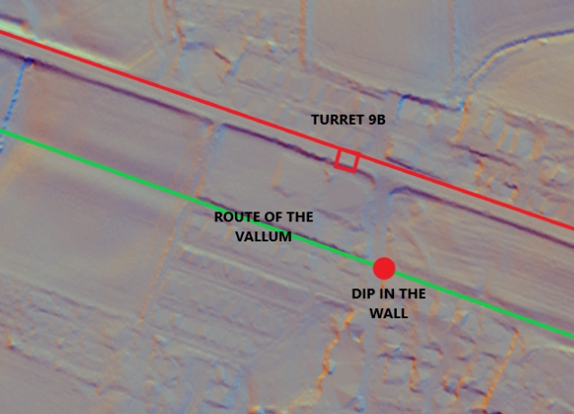
It’s just off the beaten track, near the site of Turret 9B. You can see on the Lidar where the Vallum continues its route west past the school, following its master, the Wall, like a faithful sheep dog
Beneath this modern boundary lies the buried spine of the Vallum, the great Roman earthwork that once ran south of Hadrian’s Wall like a second frontier. Defensive ditch, symbolic border or statement of imperial control, we still debate its purpose. But its presence is undeniable.
In this old stone wall, the Vallum reaches up like a ghost, subtly distorting the course of the stones above. A higher few courses of stone on top of the dip, rises to correct the subsidence, framing the Vallum’s outline like a shadow in the landscape. The slow entropic decay of the wall into its Vallum grave making someone’s teeth itch enough to rectify the non-linearity with a nice flat top
Look closer, some blocks here bear the squared faces and tooling marks of Roman hands scavenged stones from the Wall itself, repurposed, reused, but never truly erased.
And then… by pure chance, as my iPhone camera snaped the shot, a dove breaks into the scene caught mid-flight above the wall. The Romans released doves at funerals to symbolise the soul’s journey to the afterlife.
Perhaps it’s coincidence. Perhaps not. Perhaps, just for a moment, the soul of the Vallum found its wings rising from the earth in a soft curve of stone and feather, a breath of Rome exhaled into the air.

What Was the Vallum?
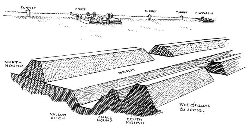
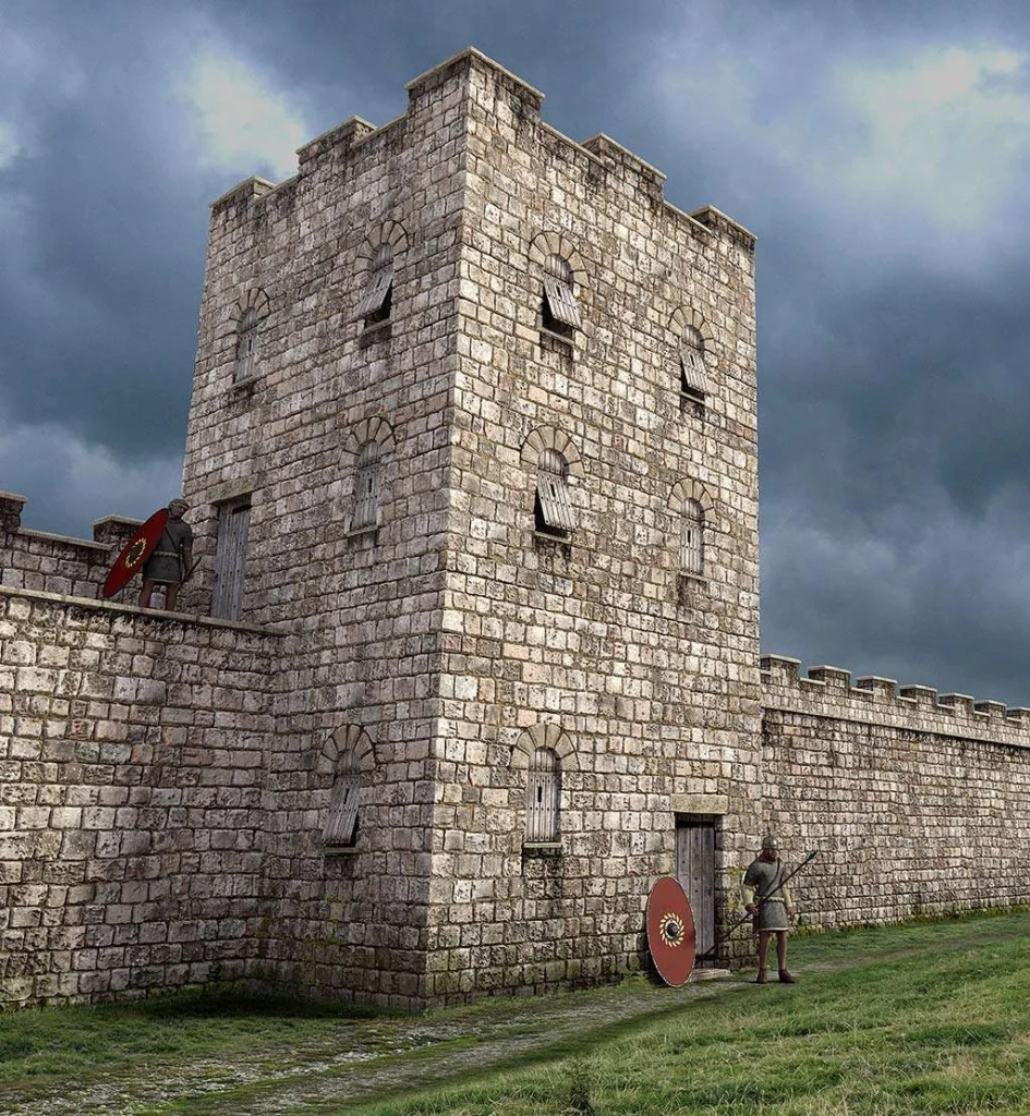
The Vallum was no small ditch. Running parallel to Hadrian’s Wall, but some 20 to 40 metres south of it, sometimes as much as a kilometre, it was a massive linear earthwork:
- A flat-bottomed ditch around 6 metres wide and up to 3 metres deep
- Flanked on either side by high mounds (agger banks) of soil, each about 6 metres wide and 2 metres high
- In some places, a berm or palisade trench sat between the ditch and the north mound
It stretched across the landscape with purposeful intent, a visible boundary carved by hand and muscle.
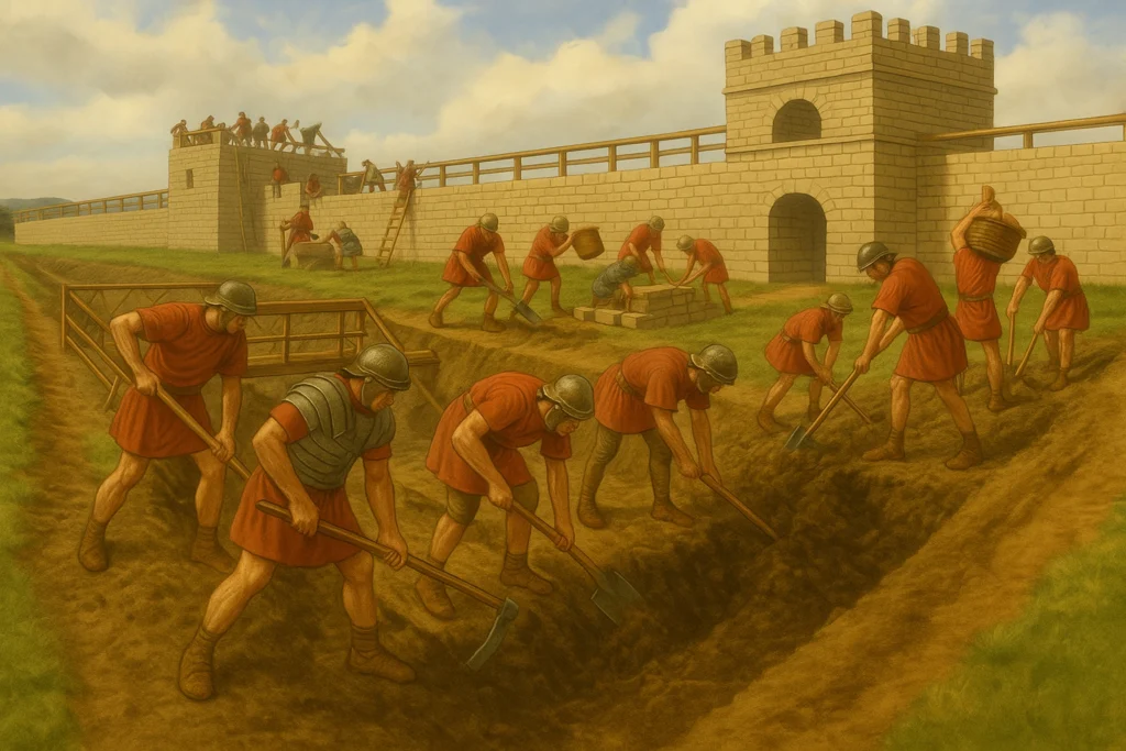
Built by Legionaries and Signed in Stone
Near West Denton, Turret 7A and Walbottle, several centurial stones were discovered between 1934 and 1953. These carved inscriptions marked which Roman centuries (units of around 80 men) built sections of the Vallum. This provides evidence that as much pride and effort was put into this earthen structure as there was in the Wall itself.
Among them:
- Centuria Tullii
- Centuria Valeri Flavi
- Centuria Aelius Didae (Cohors I Dacorum)
- And others naming Julius Rufus and the Second Legion’s 8th Cohort
These stones confirm the Vallum was built as a formal, organised military operation, almost certainly in the 120s–130s AD, as part of, or shortly after, the construction of the Wall.
Each stone is a literal Roman footprint in the soil of Tyneside. One that is still visible in the patterns of sagging walls and old field lines, if you know where to look.
Why Build the Vallum?
Scholars still debate its purpose, but several strong theories exist. The more supported ideas include:
- A controlled military zone, creating a secure corridor between Hadrian’s Wall and the Vallum where only authorised personnel could move.
- A way to channel all movement (civilian, trade, military) to controlled crossing points, where permits or checks may have been required.
- A rear boundary to defend against incursions from the south, though it was clearly more symbolic or administrative than purely defensive.
The Condercum Crossing — A Prototype?
Intriguingly, the only known fortified formal Vallum crossing ever excavated is at Condercum, the Roman fort at Benwell in Newcastle. Here, a carefully built stone causeway was constructed across the Vallum ditch, suggesting an official, planned route allowing access from the civilian side to the military zone. But no other such crossing has been found along the Wall.

This raises fascinating possibilities:
- Was the Condercum crossing a prototype — part of an early plan to allow regulated access across the Vallum?
- Did the Roman frontier strategy change mid-construction, abandoning similar crossings elsewhere?
- Or have the others simply been lost, destroyed or remain undiscovered beneath fields and housing estates?
Either way, Condercum remains a lonely anomaly — a single physical doorway through a ghostly boundary, and as usual, we have been left with more questions than answers.
Today, Just a Shadow
In places like Walbottle, the Vallum lingers almost invisibly, a ghost under footpaths and fences. Its presence is betrayed in the more modern wall and in roads and fields nearby. But sometimes, just sometimes, a dove will take flight and you’ll catch a glimpse of Rome’s ghost still rising from the ground.
With Love from the Crasterfarian XX