By Crasterfarian
Introduction
As you head up the A68 from Corbridge you are travelling on the early trails of the legions. The road you are on was part of Dere Street or known as Dierastrasse in Saxon times and linked the towns of Corstopitum (Corbridge) and Timontium (Newstead) in the Scottish Borders and many Roman forts between. The Roman name for the road has been lost to the mists of time.
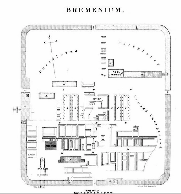
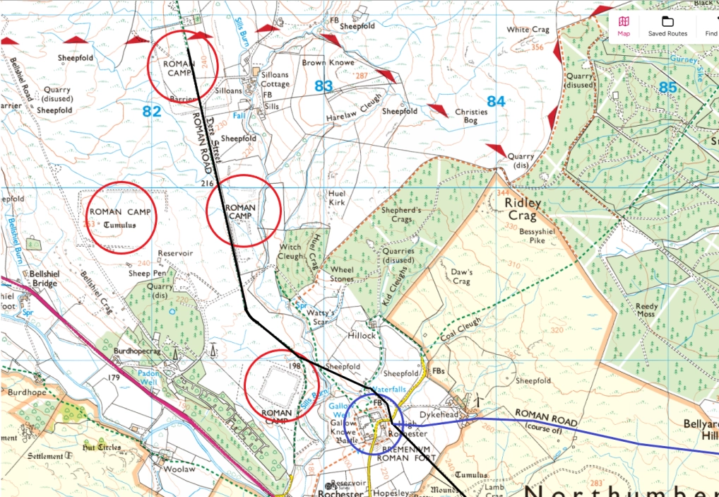
As you reach High Rochester, circled in nlue, you find the Roman fort of Bremenium. The name likely derives from Brittonic roots meaning ‘hill place’ or ‘fort on the hill’. The fort was founded around AD 80, during the Agricola campaigns to conquer and control northern Britain. It must have been a lonely bleak posting here, especially in the winter.
This was a frontier outpost, initially a supply and staging point for northern advances. Later it became a frontier fort once Hadrian’s Wall became the main northern limit and the retreat from the Antonie Wall was completed around AD 140.

There are many temporary forts around High Rochester, circled in red. This would suggest a wild, untamed and ruthless place. Combine that with the multi-fort complex at Chew Green at the border with Scotland, and it makes for an interesting military and topographic area, as it still is today with the Otterburn Military Ranges surrounding it.
However, why all the temporary forts? Was this relatively sheltered valley a campaign stopping off point to avoid crossing of the Cheviot ridge through the ravages of a Northumbrian winter?
As Dere Street passes to the east of the fort, another road branches off to the east. This road leads all the way to Alauna at Learchild. This important route not only joined the two forts over the 19 miles of its length through and over some rough terrain, but also provided a link to several sacred sites to the Romans.
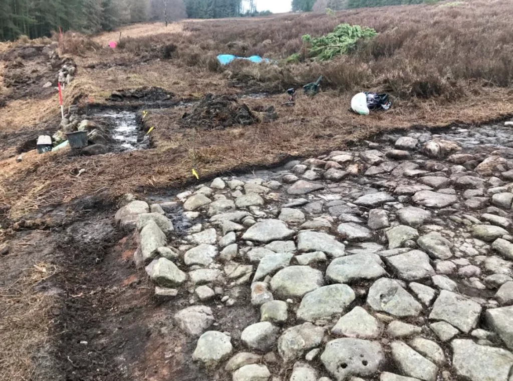
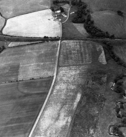
Before the road branches off, there are several Roman tombs that straddle Dere Street, as detailed in the is picture courtesy of megalithic.co.uk
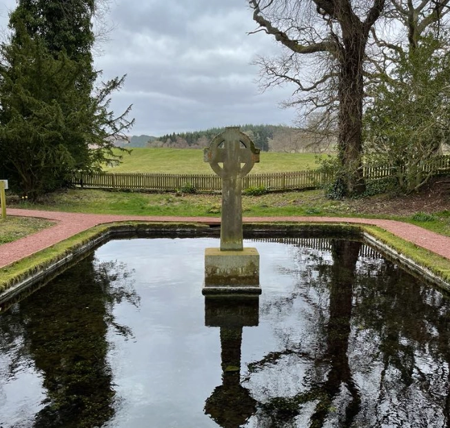
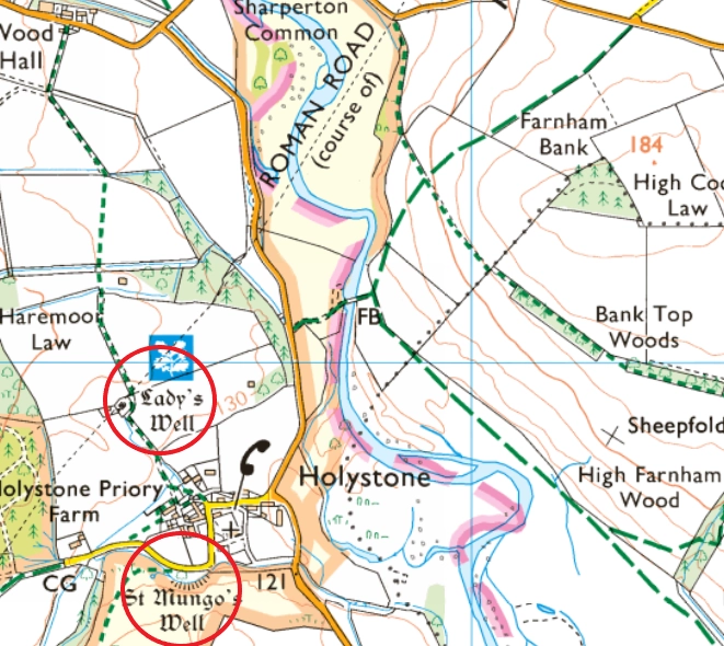
The route continues and links other such important sites as the shrine to Cocidius and Lady’s Well.
Cocidius and the Indigenous Sacred Landscape
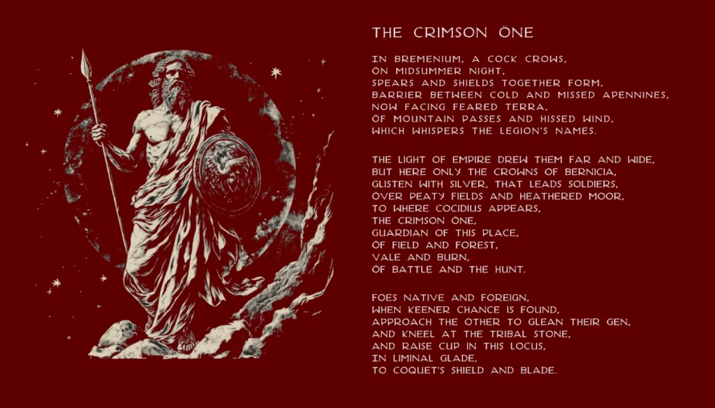
Cocidius, a syncretic god of war and woodland, was honoured by garrisons throughout North Britain. A shrine to this god is located near South Yardhope, in the rocks to the south of a marching camp and was only discovered in the 1980s. I often wonder how many soaking wet, freezing cold Squaddies sheltered in the niche near the bass relief carving whilst on exercise, not knowing what it was until an archaeologist ‘discovered’ it.
The shrine isn’t far from the road and may have served as a ritual stopping off point. The nearby River Coquet may preserve his name (Cocidius > Coced > Coquet), showing how Roman-pagan worship influenced local toponymy.
Bewcastle Fort to the west, up the Maiden Way from Banna Fort is named Fannum Cocidi after this god and is built within an Iron Age hillfort, unique in the Roman Empire because of its hexagonal shape.
This reinforces the idea of a spiritual frontier, where Roman control adapted to indigenous belief systems, as in the case of the shrine to a local Celtic God named Antenociticus near Condercum (Benwell) Fort.
The Romans were very superstitious and will have adopted local gods for fear of feeling their wrath.

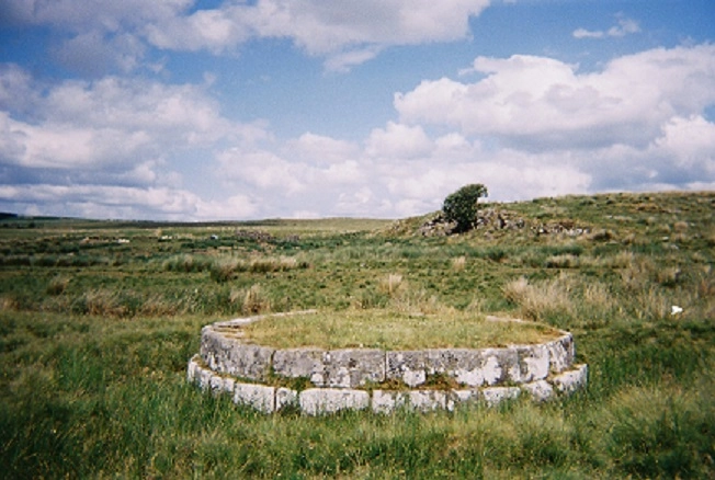
Sacred Waters – Lady’s Well and St Mungo’s Well
Lady’s Well, near Holystone, was a Roman sacred spring and stopping off point on the route east. It was later Christianised and associated with St Ninian and St Paulinus. Nearby St Mungo’s Well may reflect early Celtic-Christian reverence for sacred waters, building on earlier practices but burying the pagan sites in the new religion of Christianity. These sites underscore the road’s spiritual continuity — used by soldiers in one era, and missionaries in the next.
Paulinus in Coquetdale
Paulinus, the 7th-century missionary bishop, is said to have baptised hundreds in rivers across Northumbria. Though Bede names the River Glen, strong local tradition links Paulinus with Upper Coquetdale, including Lady’s Well. His presence along this Roman route indicates it remained a well-travelled corridor into the early medieval period, repurposed from a warpath to baptismal route.
Place Names and Lingering Echoes
Alauna, the fort at Learchild, likely gave rise to the name of the River Aln. Similarly, Coquet may derive from Cocidius, preserving the name of a forgotten god in everyday geography. These rivers are linguistic fossils, marking where Roman roads, native belief, and imperial infrastructure once converged.
Conclusion
The Bremenium–Alauna route was more than a Roman road: it was a multifunctional artery, carrying soldiers, supplies, pilgrims, and later, Christian missionaries. As a vital winter relief road linking the forts, it served a practical need while also traversing deeply sacred ground.
The enduring presence of Cocidius in the landscape, the baptisms of Paulinus, and the rivers that still bear Roman and native names alike all testify to the road’s lasting role in shaping Northumberland’s spiritual and physical geography.
With Love form the Crasterfarian XX
See also:
The Crimson One
Would love to see a major excavation of the Roman fort at Bremenium. I visited many years ago and was surprised at the extent of the remains. Always like to read of folks’ ideas and theories about the Roman landscape – so much still to uncover.
Hi Mick, I’ve been told there’s an excavation every summer and Terry Frain is the archaeologist.