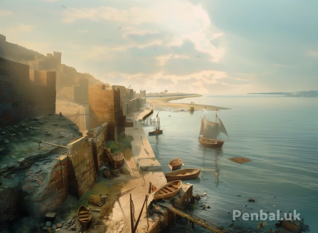
No one knows where the port for Arbeia was, where so many tons of goods, people and coinage passed through so many centuries ago. But as I was sat on Tyne Street gazing across the river, it dawned on me that it could only be in one place.
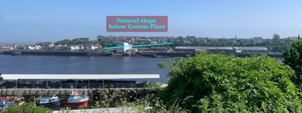
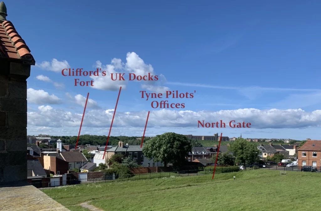
There’s no question that Arbeia is built on a slope towards the river from south to north. There’s also a slight slope from east to west, making the north west corner the lowest point of the fort. At 50 yards past the northern end of the fort there’s a steep drop down to the riverside area on Wapping Street. Athough the river is a further 50 yards from Wapping Street, in Roman times the river would’ve reached as far as the road.
The steep drop is not clearly visible from the top on Green’s Place, which is badly overgrown. This sheer bankside can only really be appreciated from the North Shields side and only slightly from the road below. Looking from across the water it appears to be built on a slope, making the drop from the east end of Green’s Place rather less than from the west end of the street.
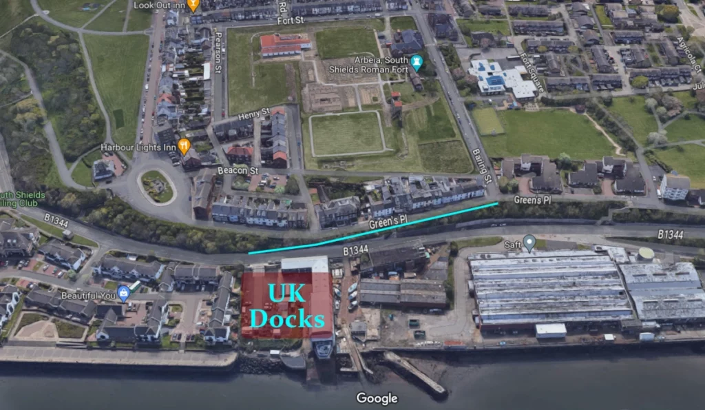
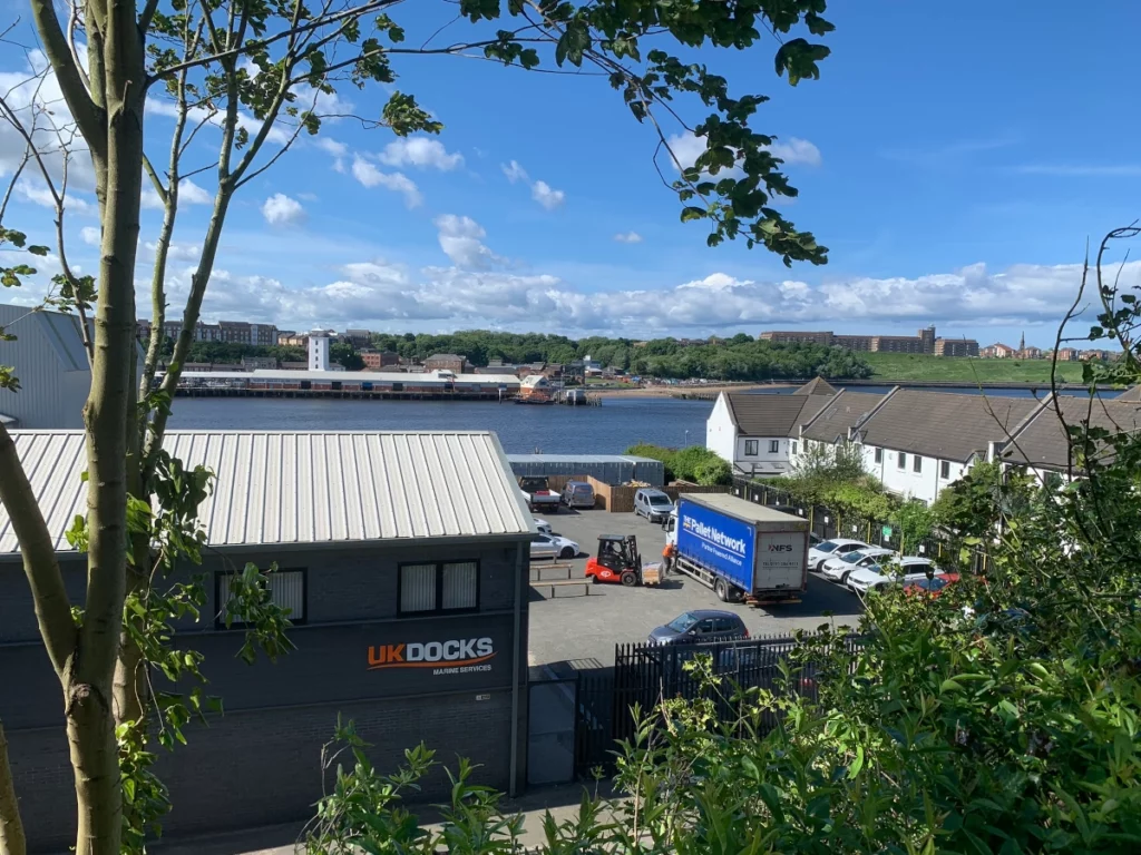
Given this, I believe the Roman dock was where the UK Docks dry dock is today, with jetties extending into the river. There was probably zig-zag to below where the Tyne Pilots House is, a natural lookout spot, where a path led straight up to the north gate and two other paths led off to the north east and north west corners en route to the east and west gates respectively.
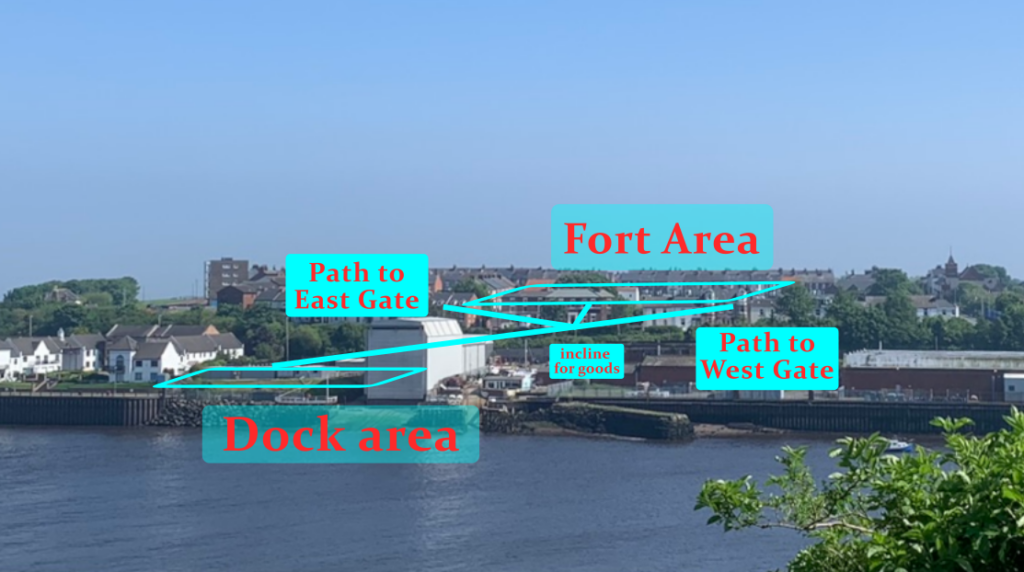
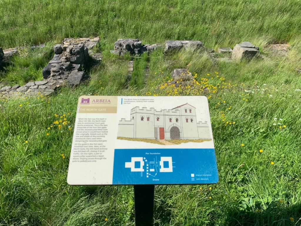
It seems in the early part of the fort’s life the North Gate was the main gate, but its arch was at some point bricked up and presumably heavy goods then entered via the East or West gates.
The eminent archaeologist Sir Ian Richmond (1902-1965) asserted that the dock was at Mill Dam, while Stephen Speak argued it was at the site of the Marine Training School, i.e. at the end of Mile End Road and under Wapping Street. While others claim the port lay on the Herd Sands side.

In my view the dock has to be at both the closest and most accessible point to the fort. Just looking at it from a distance, the UK Docks area looks and feels right and furthermore it’s directly across from the site of Clifford’s Fort which I believe was a key navigation and crossing point right at the Narrows: penbal.uk/a-roman-pharos-at-north-shields/
Of course the ground level was much lower in Roman times before any ballast was added to the area. I’m aware of how much further back the shore was in ancient times and I’m also aware of how heavily this land has been occupied and worked on over the centuries. But Raymond Selkirk points our so clearly in his 1983 book, The Piercebridge Formula, natural features like ridges and tree lines don’t just disappear from landscapes. They often subtly indicate the presence of older structures.

Much remains unexcavated and to be discovered…
References
South Shields, Roman port sitelines.newcastle.gov.uk HER 910
Richmond, 1934, ’The Roman Fort at South Shields’, Archaeologia Aeliana, 4th Series, Vol 11, p84
Speak, 1994, ‘Excavations at South Shields Roman Fort’, Volume 1, p10-11, p15
Archaeological Practice, 1997, ‘Littlehaven, South Shields, Proposed Hotel Development: Archaeological Assessment’, p13
Listen to the audio for this post here:
Never miss an article. Enter your email or give our FB page a like


No air-built castles, and no fairy bowers,
But thou, fair Tynemouth, and thy well-known towers,
Now bid th’ historic muse explore the maze
Of long past years, and tales of other days.
Pride of Northumbria!—from thy crowded port,
Where Europe’s brave commercial sons resort,
Her boasted mines send forth their sable stores,
To buy the varied wealth of distant shores.
Here the tall lighthouse, bold in spiral height,
Glads with its welcome beam the seaman’s sight.
Here, too, the firm redoubt, the rampart’s length,
The death-fraught cannon, and the bastion’s strength,
Hang frowning o’er the briny deep below,
To guard the coast against th’ invading foe.
Here health salubrious spreads her balmy wings,
And woos the sufferer to her saline springs;
And, here the antiquarian strays around
The ruin’d abbey, and its sacred ground.
Jane Harvey
From ‘The Castle of Tynemouth. A Tale’ (1806)
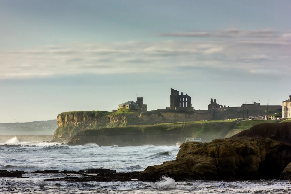
Photograph: Lee Stoneman
Photograph: Lee Stoneman
No air-built castles, and no fairy bowers,
But thou, fair Tynemouth, and thy well-known towers,
Now bid th’ historic muse explore the maze
Of long past years, and tales of other days.
Pride of Northumbria!—from thy crowded port,
Where Europe’s brave commercial sons resort,
Her boasted mines send forth their sable stores,
To buy the varied wealth of distant shores.
Here the tall lighthouse, bold in spiral height,
Glads with its welcome beam the seaman’s sight.
Here, too, the firm redoubt, the rampart’s length,
The death-fraught cannon, and the bastion’s strength,
Hang frowning o’er the briny deep below,
To guard the coast against th’ invading foe.
Here health salubrious spreads her balmy wings,
And woos the sufferer to her saline springs;
And, here the antiquarian strays around
The ruin’d abbey, and its sacred ground.
Jane Harvey
From ‘The Castle of Tynemouth. A Tale’ (1806)